
How To Topic 22 · Map views
How to Switch Between STD, SAT, M3D and HxAR Map Views
A Property Visit can present the same virtual location through four different renderers. STD and SAT use Apple MapKit, M3D uses Mapbox, and HxAR opens the app’s own virtual geographic world. Choose the view that matches the task rather than treating them as four versions of the same imagery.
What this guide achieves
Switch map modes confidently, understand what each renderer is showing and avoid confusing a virtual HxAR layer with provider imagery or surveyed mapping.
- Topic
- 22
- Starting point
- An outdoor Property Visit with the four-part STD, SAT, M3D and HxAR selector visible
- Guide time
- About 9 minutes
- Screen status
- Development feature guide
Quick walkthrough
Compare the four Property Visit views in eight steps.
Begin with the HxAR default, then switch through the provider views while preserving attribution and checking which controls remain available.
- 01
Open an outdoor Property Visit
Use Visit Location on an actively owned individual property, or open the outdoor route for an eligible property group without a saved VR Building.
- 02
Begin in HxAR
Every new Property Visit currently opens in HxAR Metaverse. Ordinary Map Search is different and still begins in STD.
- 03
Find the four-part selector
Use the compact STD, SAT, M3D and HxAR control in the location header. OWNER LOCATION is a context label, not proof of physical land ownership.
- 04
Choose STD for a familiar map
STD opens Apple’s Standard map with realistic elevation and the visible HxAR grid overlay.
- 05
Choose SAT for aerial context
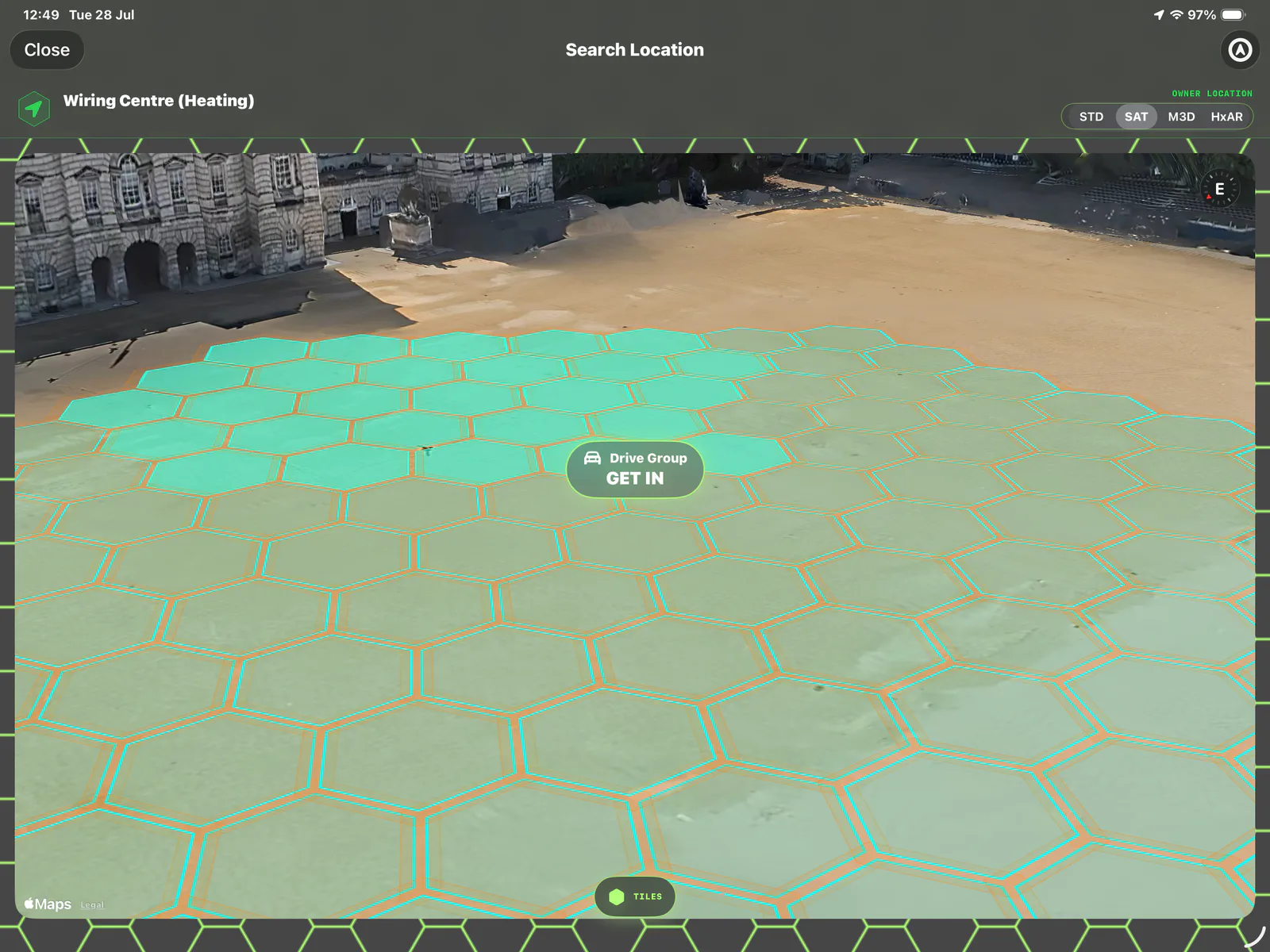
SAT opens Apple satellite imagery with realistic elevation. Treat the imagery as provider content, not a guarantee that it is live or current.
- 06
Choose M3D for Mapbox depth
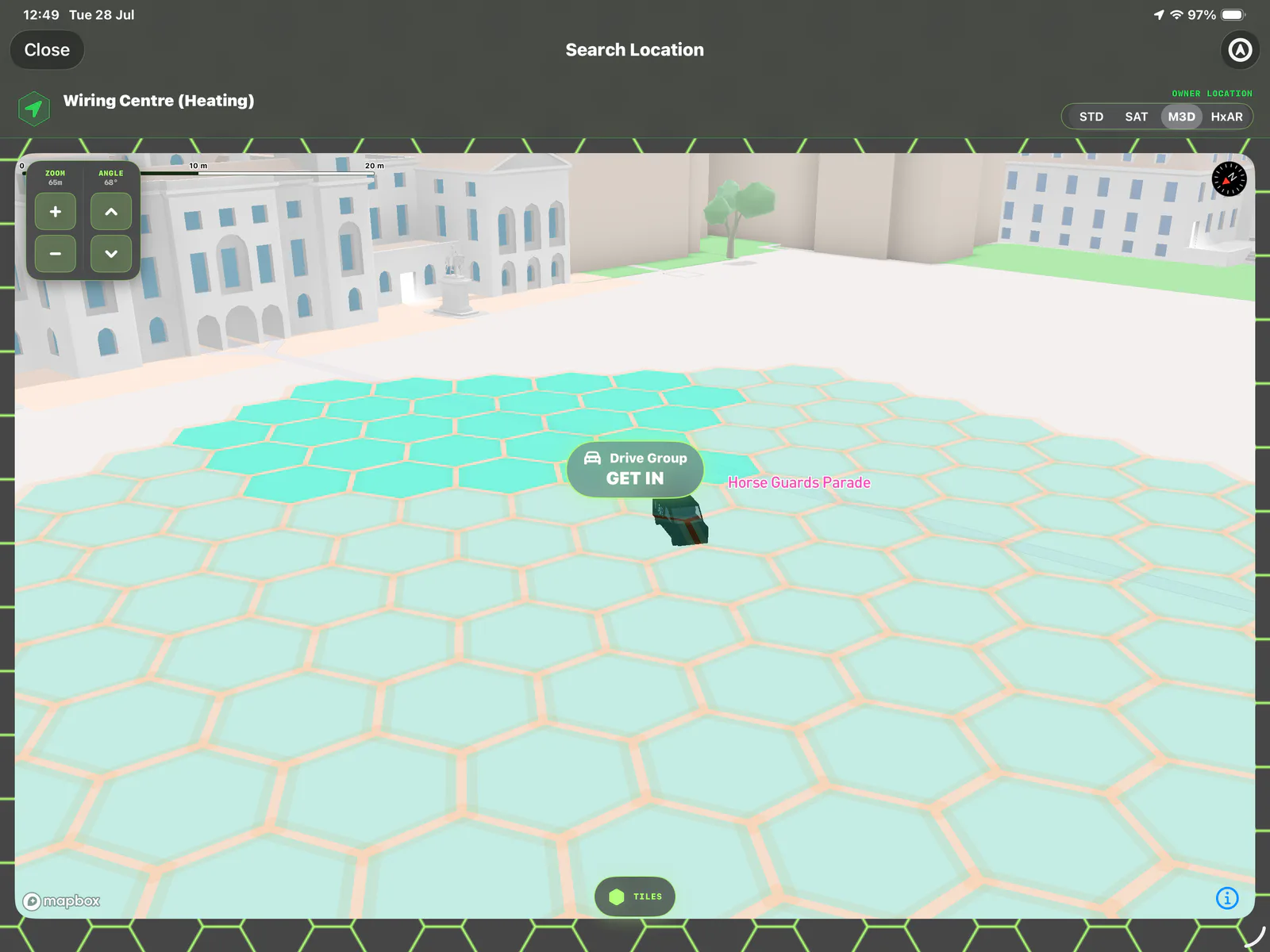
M3D opens Mapbox’s 3D presentation with available buildings, façades, landmarks, objects and trees. Availability and completeness vary by place.
- 07
Return to HxAR for the virtual world
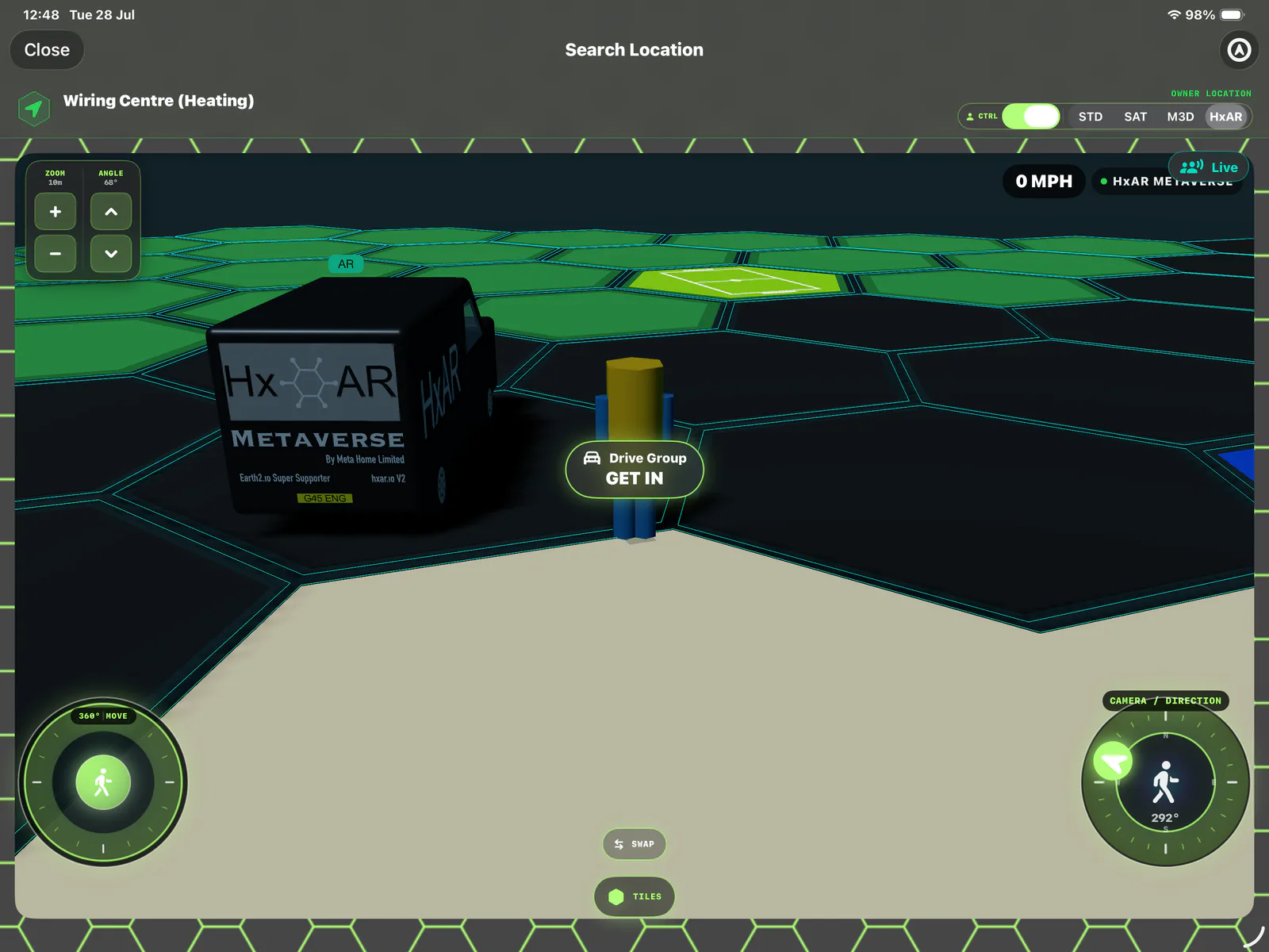
HxAR opens the app-owned SceneKit world with HxAR terrain, all 22 active colour types, virtual buildings, Story assets, avatar movement and vehicle gameplay.
- 08
Check direction, grid and attribution
Use TILES to show or hide the virtual grid, use Zoom and Angle in M3D or HxAR, and keep Apple or Mapbox logos and legal attribution visible whenever their content is shown.
Continue with the HxAR 2.1 guides
The map-style comparison below includes earlier terrain behaviour. In HxAR 2.1, Water, River and Lake support wading, while Sea retains sink-and-return behaviour. See the new water guide for the updated experience.
HxAR is the Property Visit default—not the default everywhere
Every newly opened Property Visit currently starts in HxAR Metaverse. The selected map mode is not remembered for the next visit, so reopening the property returns to HxAR.
Normal Map Search and Search Location are separate routes and continue to start with STD. Describe HxAR as the Property Visit default rather than the universal map default.
Camera direction, distance and pitch are saved locally per user, property and mode. Each mode can therefore retain its own framing even though the selected mode itself resets to HxAR on a new visit.
What STD, SAT, M3D and HxAR actually mean
The four abbreviations select different renderers. They do not represent increasing levels of accuracy, and M3D and HxAR are not alternative satellite layers.
STD · Apple Standard map
Apple MapKit’s standard presentation with realistic elevation. Use it for familiar map context while retaining Apple attribution.
SAT · Apple satellite imagery
Apple MapKit’s imagery presentation with realistic elevation. It adds aerial context but is not described as live imagery.
M3D · Mapbox 3D view
A Mapbox Standard day presentation with 3D content where the provider has it. It is not the SAT imagery layer.
HxAR · HxAR Metaverse
HxAR’s own SceneKit geographic world with no Apple or Mapbox map underneath. It is the only mode for HxAR terrain, additional active colour types, procedural-building interaction, avatar walking and nearby boarding; selected Story assets and active Drive Groups can also appear in provider views.
SAT and M3D provide different real-world context
SAT can help relate the virtual grid to visible aerial features. M3D can make building form and surrounding depth easier to understand. Provider coverage, age and detail vary, so neither view should be used as a surveyed boundary or safety assessment.
STD, SAT and M3D normally use an owner profile colour for the HexTile overlay when one is available, otherwise cyan, with an orange outer outline. Those overlays are not the active-terrain and additional-colour palette rendered by HxAR.
HxAR is the interactive virtual geographic world
HxAR replaces the provider basemap with the app-owned virtual renderer. It can show active terrain, additional active colour patterns, grouped Property Land, virtual buildings, selected Shared Story assets, the walking avatar, vehicles and optional short-lived multiplayer presence.
In the earlier version described here, Grass’s driving limit and Water’s submerge-and-return behaviour applied only in HxAR. Switching to STD, SAT or M3D stops HxAR-only avatar walking, procedural-building interaction and multiplayer and resets transient effects such as water or vehicle auxiliary state. Shared Story assets and an active Drive Group can still appear in the provider views. For HxAR 2.1 water and bridge-deck behaviour, follow the updated water guide.
HxAR can draw its procedural grid without a streamed provider basemap, but current ownership, terrain, additional colour types, groups, Story assets and optional multiplayer still depend on cloud or network services. It should not be described as fully offline.
TILES, CTRL and OWNER LOCATION are easy to misread
TILES only shows or hides the virtual HexTile grid and prevents tile selection while hidden. CTRL only shows or hides Avatar or Drive Group controls; it is not an ownership, administration or multiplayer switch.
OWNER LOCATION identifies the Property Visit context. It does not confirm physical land ownership. In STD, SAT and M3D the header remains at the property coordinate; in HxAR it follows the virtual avatar or vehicle position.
The Zoom and Angle panel is available for M3D and HxAR. The four-part selector and camera controls have spoken accessibility labels, but the detailed 3D world remains substantially visual and should not yet be described as fully accessible.
M3D needs Mapbox; no view is a navigation guarantee
M3D requires the Mapbox SDK and a valid public Mapbox token. If either is unavailable, HxAR displays a Mapbox unavailable message and asks the user to choose STD or SAT. It does not silently switch to Apple Maps.
Apple and Mapbox basemaps depend on their services for complete content, and HxAR has no user-managed offline map package. A map may be incomplete or unavailable because of connection, provider or configuration conditions.
Keep Apple and Mapbox logos and legal attribution visible in screenshots and recordings. Before treating this development guide as App Store behaviour, verify that the app’s privacy notice and App Store disclosure cover the production Mapbox SDK.
Choose a view for context, never for physical permission or safety
None of the four views provides surveyed boundaries, turn-by-turn navigation, access rights, planning consent or proof that a physical route is safe. Public labels and 3D forms can also be incomplete or out of date.
A Property Visit header displays its location name and coordinates. The screenshots on this owner-only website preview use opaque privacy masks over their coordinate lines and contain no embedded EXIF, XMP or GPS metadata. Review any custom property title before a later public release.
Stop before comparing modes, never use the controls while driving and stay alert to roads, water, steps, private property and other people.
Guide path
Move through HxAR one topic at a time.
New topics will be linked back into earlier guides whenever one action leads naturally to another.
Helpful now